One map for everything moving across Britain — land, air and sea.
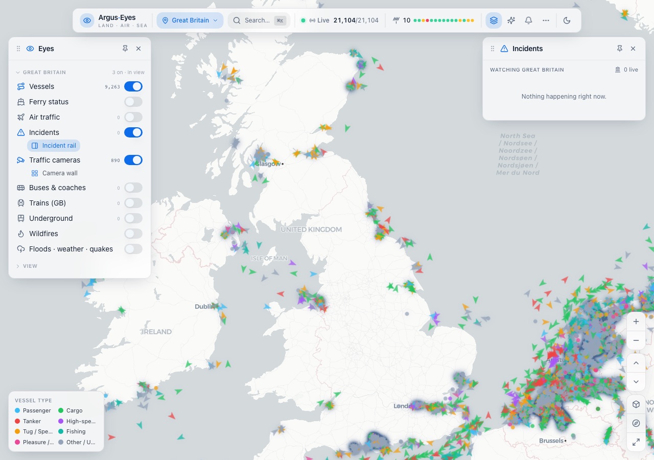
The feeds that describe what is happening across the country — ships, aircraft, trains, buses, the Underground, hundreds of traffic cameras, flood and weather and earthquake alerts — are all public, and all separate. Each one is a different shape arriving at a different rate, and nobody can hold ten browser tabs open and call it awareness. Argus Eyes needed them on one map that stays readable while tens of thousands of things move on it.
What we delivered.
One live map with every feed as a layer you switch on or off, so an operator builds the picture they need instead of being given someone else's.
- Vessel traffic and ferry status from live AIS
- Air traffic, trains, the Underground, buses and coaches
- 890 traffic cameras, with a camera wall for watching several at once
- Incidents on their own rail, and flood, weather, earthquake and wildfire alerts
- Search from the keyboard, pinnable panels, a region picker and a dark map for night use
Outcome.
A working picture of the country rather than a demo: on an ordinary weekday morning the map held 21,104 tracked objects, 9,263 of them vessels in view, and stayed usable on a laptop while they all moved.
Want a project like this?
Tell us what you're building and we'll show you how we'd approach it.
Start a project